ABOUT RAJA DEY
Civil engineering, powered by geospatial intelligence.
From construction sites to GIS mapping and technical property evaluation, I combine field experience with spatial analysis to deliver accurate, practical engineering solutions.
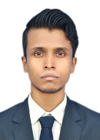
Raja Dey
Civil & Geoinformatics Engineer
Biography
The engineer behind the name.
I am a Civil & Geoinformatics Engineer with a Diploma and B.Tech in Civil Engineering and an M.Tech in Geoinformatics from Maulana Abul Kalam Azad University of Technology. My professional experience spans civil construction, site execution, GIS-based projects, surveying, and technical property assessment.
My work has taken me from field execution and drawing interpretation to geospatial analysis and property valuation. I have contributed to projects involving industrial construction, urban and regional planning, digital land records, field data collection, and the analysis of built-up changes in Kolkata using geospatial techniques.
I am interested in using engineering knowledge and geospatial technology to solve practical problems. Going forward, I want to explore the intersection of Civil Engineering, GIS, surveying, and GeoAI while continuing to build solutions that are accurate, practical, and useful in the real world.
Mission
To combine civil engineering knowledge, field experience, and geospatial technology to deliver practical solutions grounded in accurate data and real-world understanding.
Vision
To build a career at the intersection of civil engineering and geoinformatics, using emerging technologies such as GeoAI to make engineering, surveying, planning, and property assessment more intelligent and data-driven.
Working principles
What I don't compromise on.
Accuracy matters
Engineering and technical decisions should be supported by reliable data, careful analysis, and proper field verification.
Field meets technology
Digital tools are most valuable when they complement practical field knowledge and help solve real-world engineering problems.
Keep learning
Civil engineering and geospatial technology continue to evolve, so I actively look for opportunities to learn, experiment, and expand my capabilities.
Practical solutions
The goal is not technology for its own sake, but solutions that are understandable, useful, and relevant to the problem being solved.
Timeline
From construction sites to geospatial intelligence.
GIS Engineer
Geoinfra Global Solution · Jaipur, Rajasthan, India
2025 — 2025
- Worked on the DILRMP project supporting digitization of land records through spatial and statistical analysis.
- Prepared and worked with ground reference maps to support spatial accuracy and reliable land-data analysis.
- Maintained geospatial databases and collaborated on land-file monitoring using ArcGIS Pro.
Junior Technical Manager
Current
Veritas Finance Limited · Burdwan, West Bengal, India
2025 — Present
- Manage Loan Against Property (LAP), LAP-C, and NPA property valuation assignments across multiple regions.
- Conduct property identification using GIS techniques, physical inspections, market valuation assessments, and technical due diligence.
- Verify legal and technical documentation, assess collateral risks, and prepare detailed technical and valuation reports.
- Coordinate multi-location technical operations while ensuring timely and accurate evaluations in line with internal policies and regulatory standards.
Junior Engineer (Civil)
Sarralle Equipment India Pvt. Ltd. · Bokaro, Jharkhand, India
2022 — 2023
- Supervised onsite execution and coordination of civil engineering activities in an industrial construction environment.
- Monitored daily work progress while implementing quality control and safety measures.
- Interpreted engineering drawings, coordinated with contractors, and prepared site reports for management evaluation.
Site Engineer
Shreyash Engineers · Jashpur, Chhattisgarh, India
2021 — 2022
- Worked on the Jal Jeevan Mission project, monitoring daily site activities and ensuring compliance with project guidelines and quality standards.
- Coordinated with surveyors and subcontractors while supervising site activities and monitoring project progress.
- Supported preparation of Detailed Project Reports (DPRs), data collection, and project-related analysis.
Education
Foundations.
Diploma in Engineering — Civil Engineering
Nazrul Centenary Polytechnic · 2016–2020 · 1st Class
Diploma in Civil Engineering under WBSCT&VE&SD.
B.Tech — Civil Engineering
Modern Institute of Engineering & Technology · 2020–2023 · 8.35 / 10 CGPA
Academic project: Design and planning of a G+II multistoried residential building.
M.Tech — Geoinformatics
School of Information Science & Technology, MAKAUT · 2023–2025 · 7.55 / 10 CGPA
Thesis: Analyzing decadal changes (2000, 2010, 2020) in the built-up area of Kolkata Municipal Corporation using geospatial techniques.
Credentials
Certified to sign.
Microsoft Excel
Solitude Education · 2021 · ID EN/2020/1521
AutoCAD 2D & 3D
Solitude Education · 2021 · ID EN/2020/1521
Industrial Training
Solitude Education · 2021 · ID IOFHT/ST-20417
Computer Fundamental & M.S Office Internet
National Council For Vocational Training · 2013 · ID 0362-ICT101-B00033637
Professional memberships
Capability
Tools of the trade.
Technical & Professional
Technical Reporting85%
Contractor Coordination80%
Client Coordination85%
Microsoft Excel80%
AutoCAD 2D80%
Property & Valuation
Collateral Risk Assessment80%
Market Valuation Assessment85%
Technical Due Diligence85%
Property Inspection90%
Property Valuation90%
Geoinformatics
Land Data Digitization80%
Geospatial Database Management75%
Google Earth Pro80%
GIS & Spatial Analysis85%
ArcGIS Pro85%
Civil Engineering
Daily Progress Reporting85%
Quality & Safety Monitoring80%
Site Supervision85%
Field Execution85%
Drawing Reading85%
Recognition
Awards.
To do...
To do... · To d
To do...
Research
Published work.
Designing and Planning of a G+II Multistoried Residential Building
B.Tech Academic Project — MAKAUT · 2023
Raja Dey
An academic project focused on the design and planning of a G+II multistoried residential building.
Analyzing Decadal Changes (2000, 2010, 2020) in the Built-Up Area of Kolkata Municipal Corporation Using Geospatial Techniques
M.Tech Academic Dissertation — MAKAUT · 2025
Raja Dey
An academic study analyzing decadal changes in the built-up area of the Kolkata Municipal Corporation using geospatial techniques.
In the field
Where engineering meets reality.
A look at the environments that have shaped my experience — from construction sites and field inspections to surveying, GIS work, and property assessment.
Want this experience on your project?
Interested in civil engineering, geospatial work, property assessment, or a related opportunity? Er. Raja Dey is open to professional conversations and collaborations across India.
Mon – Fri: 9:00 AM – 9:00 PM IST · engineerrajadey@gmail.com